


Survey and Mapping Operations
Survey Operations and Mapping 2026
We're extremely proud to announce our all new Survey and Mapping courses for 2026. These courses have proven so popular over time, that we've done what only Dronestar™ can do, and completely re-built them from the ground up to take advantage of the very latest hardware, software and techniques in dataset capture and post-processing.
We've also changed our course delivery method from public group bookings to private only and private groups / corporate.
Why? Due the nature of current hardware and software, and our client requirements, no two courses, or clients are the same. We can only deliver highly contextualised courses to you if we keep them operation-specific. And that means private delivery only.
Previously, our course was split into two parts you could choose from. The two components consisted of dataset capture, and then post-processing. We know, one doesn't really work without the other, and from experience, we know the outcomes for all pilots on this course, are far better and more comprehensive, with a full, end-to-end delivery.
Survey and Mapping - Civil DSSOMC-26
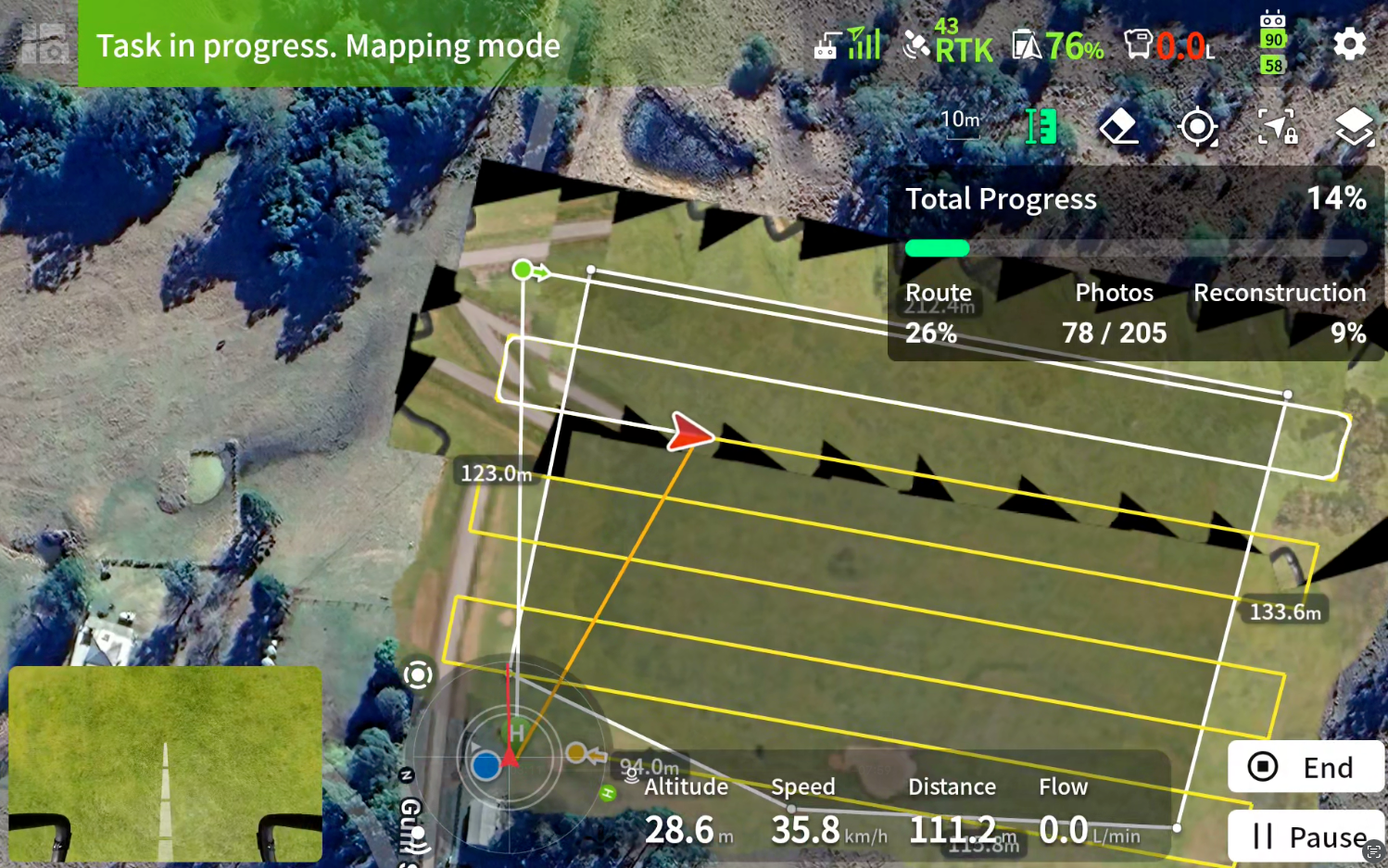
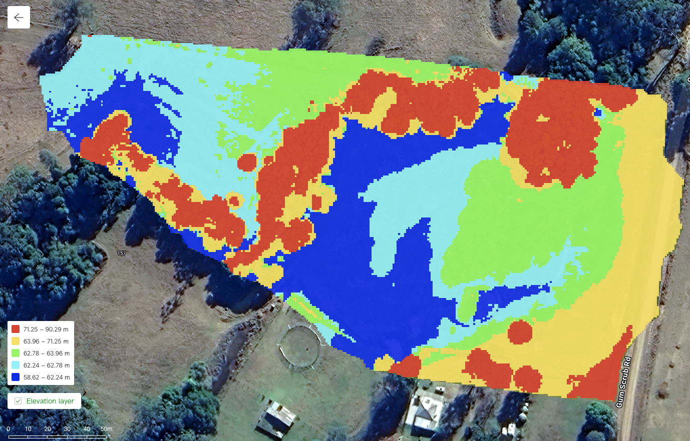
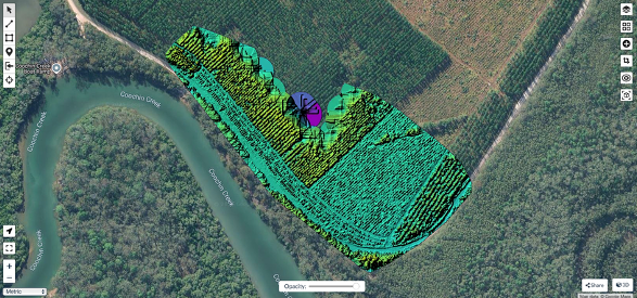
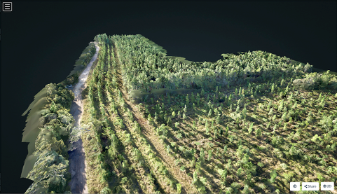
This course focuses on operations in area mapping, roadways, and structures in various forms. Using DJI Matrice and Mavic Enterprise series aircraft, we'll go out and capture various datasets using aircraft specific mapping modes. Once captured we learn how to post process with platforms such as WebODM, DJI Terra, Pix4D and uGCS depending on client requirements. This course looks at RTK positioning down to centimetre level, for precision elevations along with the practical use of Ground Control Points (GCP's)
This course is backed up with comprehensive online learning, once enrolled, with a detailed student handbook and scenario guide.
Survey and Mapping - RGB and Multispectral DSSOMM-26
This course focuses on data capture using the DJI Agriculture platform with the DJI Mavic 3 Multispectral to collect Multispectral data, process and data and prepare variable rate, precision agriculture, spray and seed plans for the DJI AGRAS series aircraft to execute. Check out our specialised courses at
Dronestar™ Ag here.This course is backed up with comprehensive online learning once enrolled with a detailed student handbook and scenario guide.
Once captured post-processing of data will be completed in WebODM or DJI Terra, to generate digital surface elevation models along with 2D and 3D extrusions. This course is backed up with comprehensive online learning, once enrolled, with a detailed student handbook and scenario guide.
Survey and Mapping - Wildlife and After-Dark DSSOMM-27
This course focuses on techniques for wildlife monitoring and counting after dark. We use the latest, and most advanced aircraft currently available from DJI and show you how to safely plan, execute, capture and post-process (where necessary).
This course is ideally suited to Rangers,Parks and Wildlife, Fire and Rescue, and professionals who aim to target these rapidly growing areas with thermal and thermal/RGB imaging with aircraft such as the Matrice 400 and Matrice 4T.
All of these courses are currently being delivered in NSW and QLD and other locations on demand. Course content available upon enrolment. Practical dates set at a mutually convenient date.
29
30
1
2
3
09:00 CASA BVLOS OCTA - Live Theory
4
5
6
7
CASA RePL GOLD COAST
8
9
10
11
12
13
14
CASA RePL SYDNEY
15
09:00 RTK Mapping Operations - Port Macquarie
16
17
09:00 CASA BVLOS OCTA - Live Theory
09:30 Remote Operator's Certificate CRP Masterclass
18
19
20
09:00 CASA Remote Pilot's Licence - Live Theory
21
09:00 CASA Remote Pilot's Licence - Live Theory
22
23
24
25
26
27
28
CASA RePL ADELAIDE
CASA RePL MELBOURNE
29
30
31
09:00 CASA BVLOS OCTA - Live Theory
1
2